How to Experience Alaska’s Glaciers: From Mendenhall to Glacier Bay and Beyond
I have watched Mendenhall Glacier through clear mornings, low clouds, summer crowds and the quieter turn after Labor Day. I have traveled by private boat into Glacier Bay, stood on glacier ice near Lamplugh, watched Margerie rise from the end of Tarr Inlet and explored around Reid Glacier when low water exposed pieces of ice along the shore. None of those experiences felt like different versions of the same attraction. Each revealed something the others could not.
That distinction is what makes Alaska’s glaciers so interesting to experience. Some are destinations in their own right, while others become part of a larger journey through mountains, water and changing weather. A glacier might fill the end of a fjord, appear unexpectedly above the shoreline or stretch beneath an aircraft until the individual rivers of ice begin to make sense as parts of a much larger system.
The most useful way to think about Alaska’s glaciers, then, is not to rank them against one another. It is to understand what each perspective reveals.
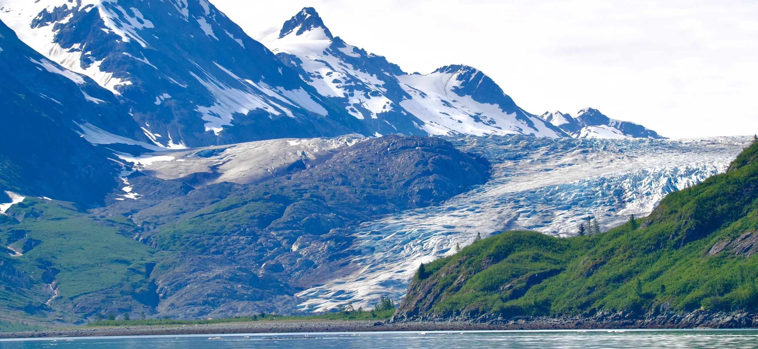
Reid Glacier on a beautiful, clear day in Glacier Bay
A quick way to understand the differences
Mendenhall Glacier is the easiest place to begin because it can be reached from Juneau without committing an entire day to a boat or aircraft. Tracy Arm and Endicott Arm are defined as much by the long fjord journey as by the Sawyer and Dawes Glaciers waiting at their ends. Glacier Bay becomes a much larger story about ice, wildlife and ecological change, while LeConte draws travelers toward Petersburg and a quieter corner of Southeast Alaska.
Flightseeing over the Juneau Icefield reveals how multiple glaciers connect to the same vast body of ice. A glacier landing turns the surface itself into the experience, while kayaking brings the scale back down to the level of water, shoreline and weather. Farther north, Hubbard Glacier and College Fjord expand the story again, showing how dramatically Alaska’s glacial geography changes as the journey continues.
There are also glaciers that rarely become the central reason for a trip. Herbert, Eagle, Sumdum, Davidson and others appear while traveling through Southeast Alaska, and those quieter encounters are an important part of understanding the region. Not every glacier needs an excursion built around it.
Mendenhall Glacier: the most accessible introduction
Mendenhall is the clearest starting point for many travelers coming to Juneau. The glacier sits within a broader landscape of lake, waterfall, forest and newly exposed ground, allowing someone to experience glacier country without committing an entire day to a boat or aircraft. Trails and viewpoints make it possible to spend a relatively short visit here or to slow down and explore the surrounding landscape more deliberately.
What keeps Mendenhall interesting to me is how visibly the place changes around the glacier. I can arrive on a bright summer morning and walk toward Nugget Falls, return during low cloud and rain, or visit after the season has begun to soften and notice the shorter days and quieter trails. The glacier itself now sits well across the lake rather than dominating the foreground, and that increasing distance has become part of the experience.
Mendenhall is often treated as the convenient glacier, but I do not think convenience makes it less meaningful. Its accessibility gives travelers time to notice the landscape that retreat is leaving behind. Forest, water, exposed ground and ice all sit within the same view, making the glacier’s movement through time unusually easy to understand.
If you are visiting the area, check out this article for thoughtful ways on how to get to Mendenhall Glacier.
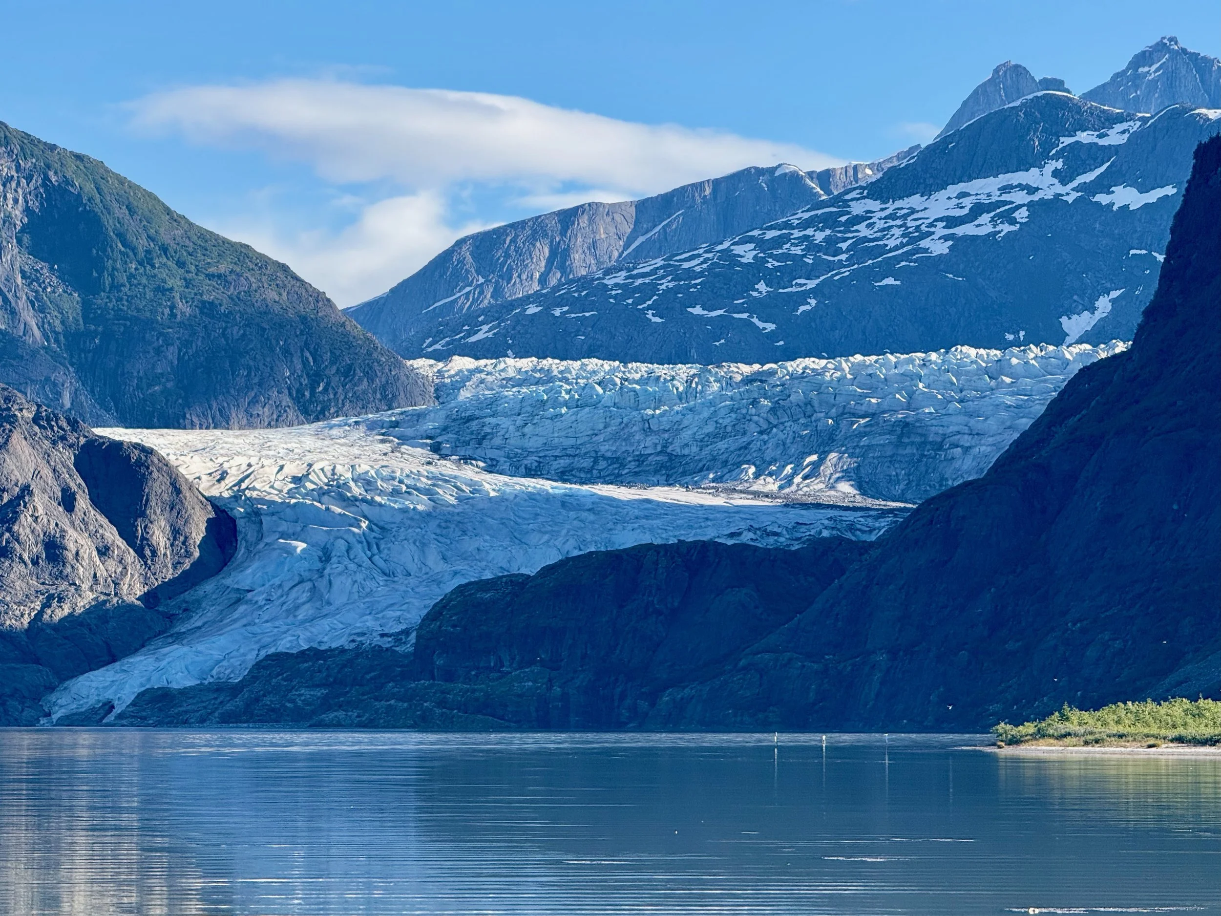
Mendenhall Glacier from the lookout point
Tracy Arm and Endicott Arm: when the journey reveals the glacier
Tracy Arm and Endicott Arm begin with a completely different rhythm. Both extend inland from Holkham Bay south of Juneau, with Tracy Arm leading toward the North and South Sawyer Glaciers and Endicott Arm toward Dawes Glacier. The glaciers matter, but the fjords themselves are the reason these experiences feel so distinct.
As the boat moves inland, the landscape gradually closes around the water. Waterfalls descend from steep mountain walls, floating ice becomes more common and the scale of the fjord becomes increasingly difficult to understand from a photograph. The glacier does not appear immediately. The landscape prepares you for it.
That gradual approach is why I think Tracy Arm and Endicott Arm are especially compelling for travelers who enjoy photography or simply like the feeling of moving deeper into a place. You have time to watch the environment change around you rather than arriving suddenly at a viewpoint. Wildlife, ice and weather may alter the day, and vessels do not always reach the same place under every set of conditions, but that variability is part of traveling through an active glacial landscape.
The 2025 landslide beside South Sawyer Glacier added another layer to that understanding. A massive volume of rock entered Tracy Arm and generated a landslide tsunami whose effects varied dramatically throughout the surrounding fjords. Close to the landslide, water reached extraordinary elevations on the mountainside, with the maximum measured runup reaching roughly 1,580 feet (yes, this still blows my mind!). By the time the energy reached much of neighboring Endicott Arm, modeling showed a much smaller wave crest, illustrating how dramatically the shape and depth of a fjord can amplify or dissipate energy.
That event does not need to define a visit to Tracy Arm, but it does change the way I look at the landscape. The fjord walls are not simply scenic evidence of geological forces that acted long ago. Ice, rock and water continue to reshape this country.
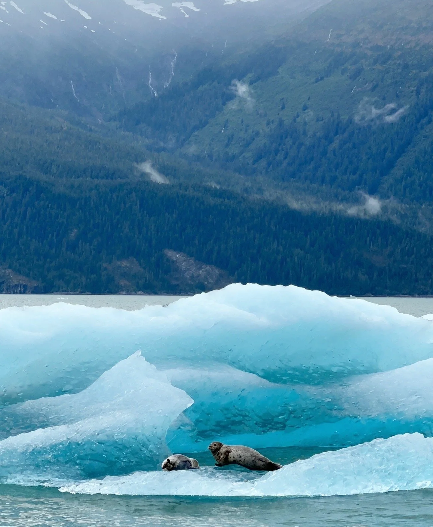
Seals on a chunk of glacier ice floating along
Glacier Bay National Park: an entire landscape shaped by ice
Glacier Bay is different because the glacier experience cannot be reduced to one famous terminus. The park holds a vast collection of glaciers in different stages of retreat, advance and grounding, and the journey through the bay reveals how dramatically the landscape has changed since ice filled much more of this country.
During my six days there, Margerie Glacier was one of the great visual moments. Its tidewater face has the scale and presence people imagine when they picture an Alaska glacier, but the longer I spent in Glacier Bay, the less I thought of Margerie as the singular destination. Reid, Lamplugh, Johns Hopkins, Grand Pacific and the land and water between them began to matter just as much.
Reid Glacier
Reid Glacier gave me a very different understanding of the bay. Because the glacier is now grounded rather than terminating directly in deep water, sediment, beach and newly exposed land become much more visible around it. During our own visit, low water exposed pieces of glacial ice along the shoreline and allowed us to experience the area at a much more intimate scale than we had at Margerie.
Margerie made me feel the scale of a glacier. Reid helped me understand what a glacier leaves behind.
Lamplugh Glacier
Lamplugh added another perspective because the glacier felt physical rather than distant. Its grounded front, outwash and visible sediment make the surface look less pristine and more geological. Standing near glacier ice changed the scale for me completely. What appears smooth from the water becomes textured, fractured and uneven when you are close enough to see the surface.
Lamplugh made the glacier feel less like scenery and more like a moving part of the land.
Johns Hopkins and Gilman Glaciers
Johns Hopkins is one of the most interesting glaciers in the park because it does not fit neatly into the simple story of retreat. It is an active tidewater glacier that has advanced during periods when many other Alaska glaciers have been thinning or receding. Numerous tributary glaciers feed into its main flow, and neighboring Gilman Glacier has repeatedly separated and reconnected with it over time.
That complexity is one of the things I most want a Glacier Bay traveler to understand. Glaciers respond to climate, ocean conditions, sediment, topography and their own geometry in different ways. Looking at Johns Hopkins alongside the other glaciers in the park makes that variation visible.
Grand Pacific Glacier
Grand Pacific is perhaps the easiest glacier in Glacier Bay to overlook because much of its lower surface is covered in rock and sediment. It does not match the clean blue and white image people often expect from a glacier, but that is precisely why it belongs in the story.
Grand Pacific is a reminder that glaciers do not need to be photogenic to be important. They carry debris, alter valleys and change shape over time, and sometimes the most interesting glacier is the one that challenges our idea of what ice is supposed to look like.
By the time you have seen Margerie, Reid, Lamplugh, Johns Hopkins, Gilman and Grand Pacific, Glacier Bay no longer feels like a sequence of viewpoints. It begins to feel like an entire landscape organized by ice.
LeConte Glacier: a reason to spend time in Petersburg
LeConte shifts the geography of the article away from Juneau and Glacier Bay and toward Petersburg. Located about twenty miles by water from the community, LeConte is Alaska’s southernmost tidewater glacier and one of the defining natural features of this part of Southeast Alaska.
The journey toward LeConte is part of what makes the experience compelling. Ice calved from the glacier can move through the bay and into Frederick Sound, meaning the landscape can begin changing well before the glacier itself comes into view. LeConte is also known for submarine calving, when ice breaks away beneath the surface and rises through the water.
I like LeConte because experiencing it naturally connects to experiencing Petersburg. Petersburg is a working fishing town, and the glacier, harbor, Frederick Sound and surrounding mountains belong to the same geography. A visit to LeConte does not need to feel like an isolated excursion inserted into a trip. It can become part of understanding the place itself.
For me, that is part of its appeal. You have to choose to go there.
The glaciers you notice along the way
Some of the glaciers I find most interesting are not necessarily the ones travelers plan entire days around. They appear through the windows of boats and aircraft, across waterways or high in mountain valleys, gradually teaching you how much of Southeast Alaska remains connected to ice.
North of Juneau, Herbert and Eagle Glaciers descend from the Juneau Icefield and can become part of the broader mountain landscape while traveling through the region. Farther south, Sumdum Glacier appears above Holkham Bay near the entrance to Tracy Arm and Endicott Arm. Around Haines, Davidson and Rainbow Glaciers become part of the wider Chilkat Range scenery, while Denver and Laughton near Skagway offer yet another possibility for travelers who want to approach glacier country on foot.
These encounters do not require a complicated itinerary. In fact, that is part of their value. You might simply be moving from one place to another when a glacier appears high in a valley and changes your understanding of the landscape around you.
Once you begin noticing glaciers this way, Southeast Alaska starts to look different. The region stops feeling like a collection of isolated attractions and begins to reveal the larger connections among mountains, rivers, fjords and ice.
Some glaciers are destinations. Others simply teach you to look up.
Flying the Juneau Icefield: five glaciers in one journey
Flightseeing provides the clearest way to understand glaciers as parts of a larger system. From sea level, a glacier occupies a valley. From the air, that valley becomes one branch of an immense network of ice.
One of the most revealing examples is the floatplane route between Juneau and Taku Glacier Lodge, which crosses Norris Glacier, Taku Glacier, Hole in the Wall Glacier, East Twin Glacier and West Twin Glacier. The value of the flight is not simply that you see five named glaciers. It is that one river of ice gives way to another, separated by mountain ridges but connected to the same broader icefield.
Taku Glacier dominates the landscape near the Taku River, while Hole in the Wall descends more steeply through the surrounding mountains. East Twin and West Twin reinforce the same idea from another angle, showing how adjacent valleys can hold separate glaciers while remaining part of the same enormous system.
That progression is what makes flightseeing so different from seeing one glacier from the ground. You begin to understand origin, scale and connection. Mendenhall no longer looks like an isolated body of ice sitting above a lake. It becomes one expression of something far larger.
For me, the one thing that I love is the texture of the glaciers from the air. It’s hard to see when you’re further away from a glacier or looking at a glacier horizontally. However, when you’re above the glacier, the crevasses become much more visual like in the photo below (I took this photo from the fixed wing airplane heading to Taku Lodge).
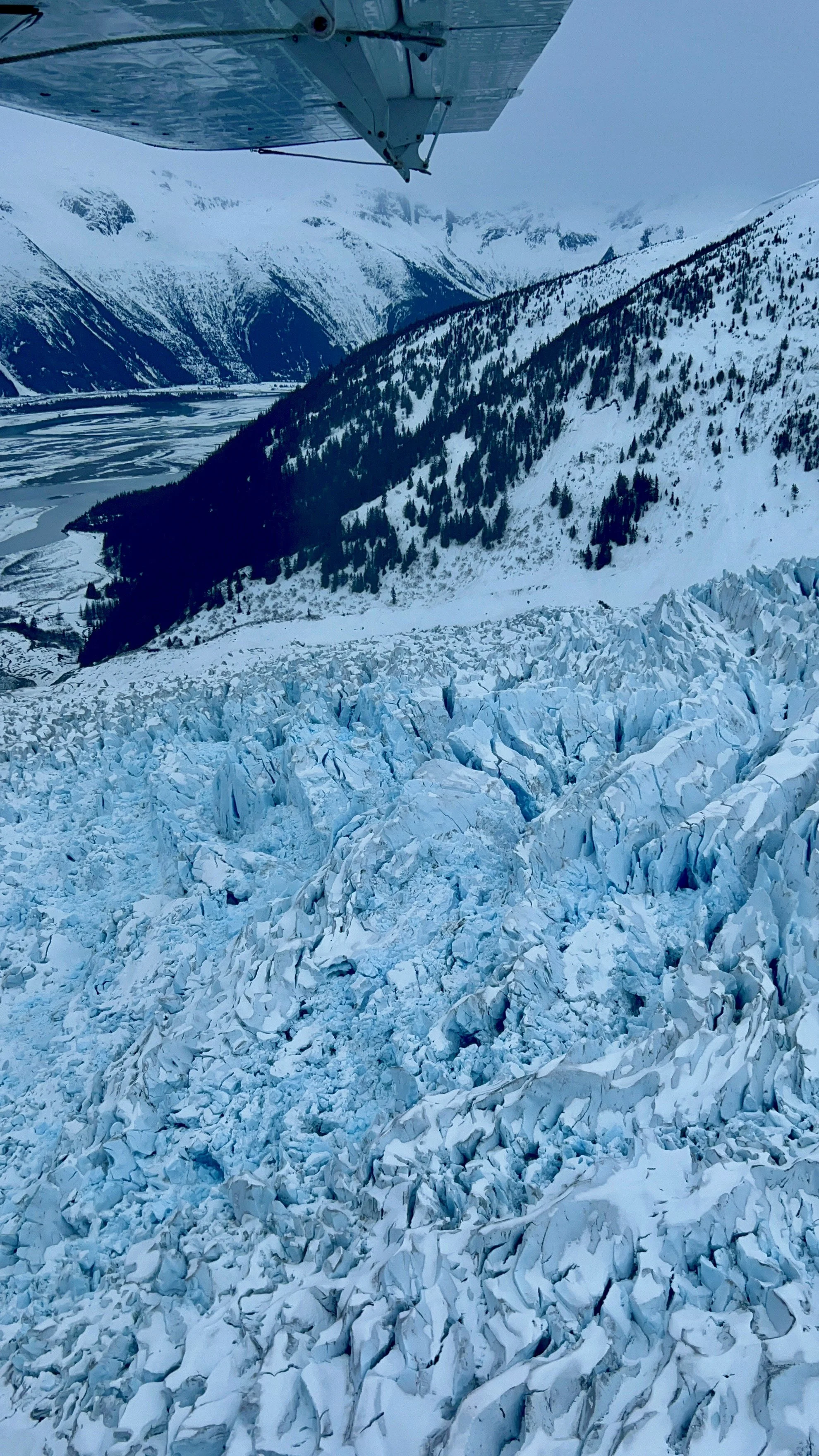
The texture of a glacier is easier to see from above (glacier along the route to Taku Lodge)
Glacier landings: when the ice becomes physical
A glacier landing changes the experience again because the surface itself becomes the subject.
From a distance, glacier ice can appear smooth and almost abstract. Up close, the surface may hold sediment, meltwater, fractures, ridges and debris. Standing on or beside glacier ice makes the landscape feel less pristine and more dynamic, because you can finally see the irregularity that disappears across distance.
I would choose a landing when physically standing on glacier ice is one of the experiences I most wanted from Alaska. The details matter, though. Some landings remain close to the aircraft, while others include guided walking or more involved exploration. Uneven terrain, weather and mobility requirements can shape the experience just as much as the flight itself.
Often times, the flight tours will combine a dog sledding experience with a glacier experience. It’s a great way to learn about Alaska’s culture, the way of life, and understand how glaciers (& the weather) have shaped the history and culture.
The value is not simply that you got closer. It is that the glacier becomes physical.
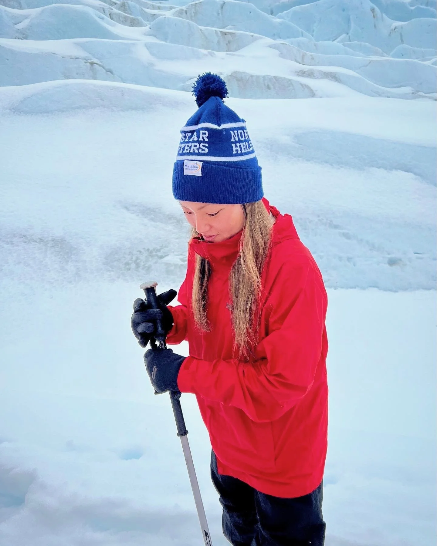
Experiencing a glacier firsthand!
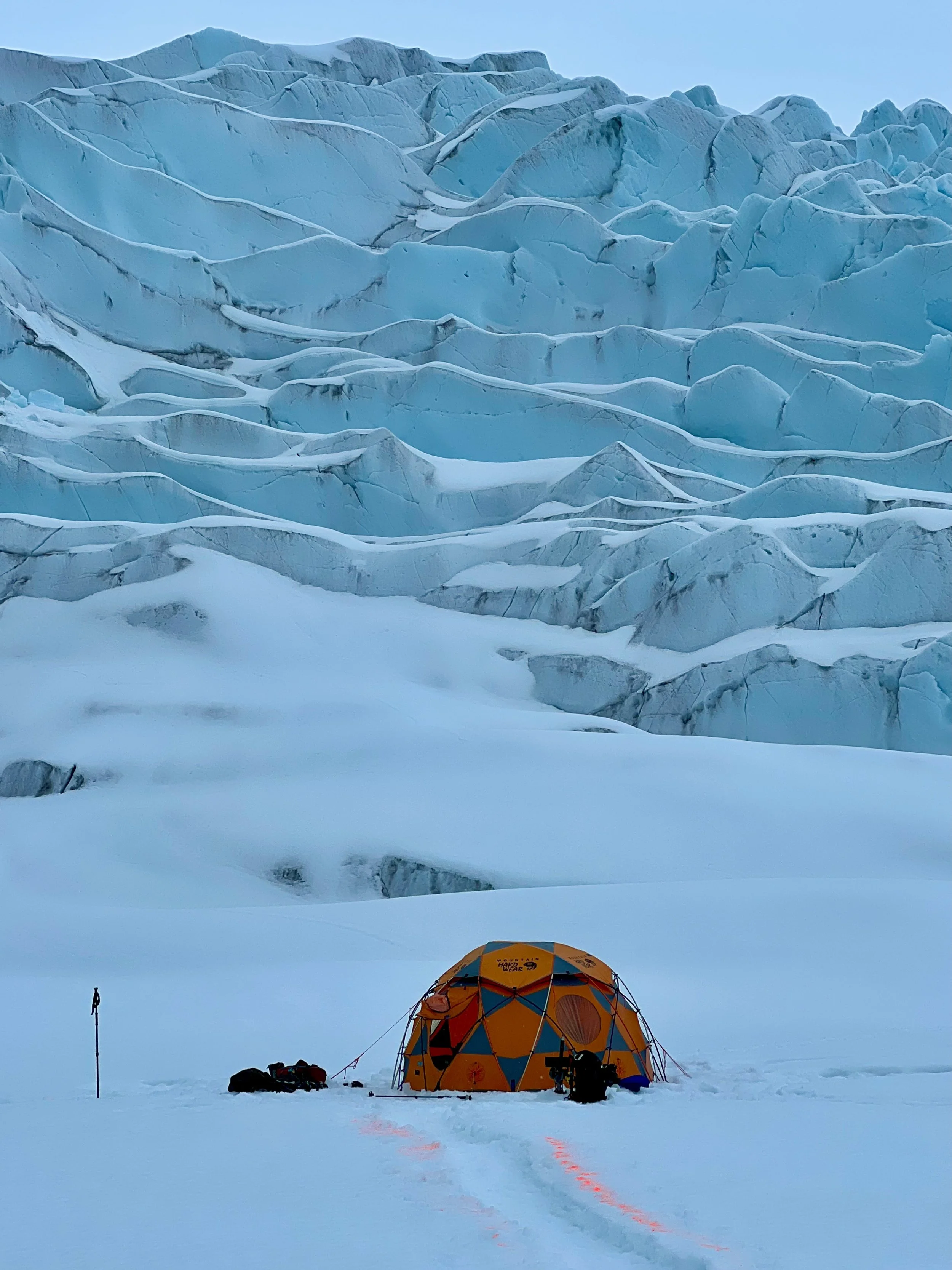
One of the tents the glacier experience teams use
Kayaking: glacier country at human speed
Kayaking creates almost the opposite perspective from flightseeing. From above, glaciers become immense systems. From a kayak, the world narrows to water, shoreline, weather and distance. Given the volatility of floating ice and glaciers, I would highly recommend experiencing this with a guide.
You notice the temperature of the air near the water, the movement of floating ice, the pull of current and the scale of the shoreline in a way that is easy to lose on a larger vessel. That slower perspective is the reason to choose kayaking.
A kayak is not a tool for getting irresponsibly close to unstable ice. Glacier environments change quickly, and cold water, tides, floating ice and wildlife all affect where it is appropriate to paddle. The value comes from moving slowly enough to notice the environment rather than from achieving a particular proximity to the glacier face.
It is glacier country at human speed - and glacial pace.
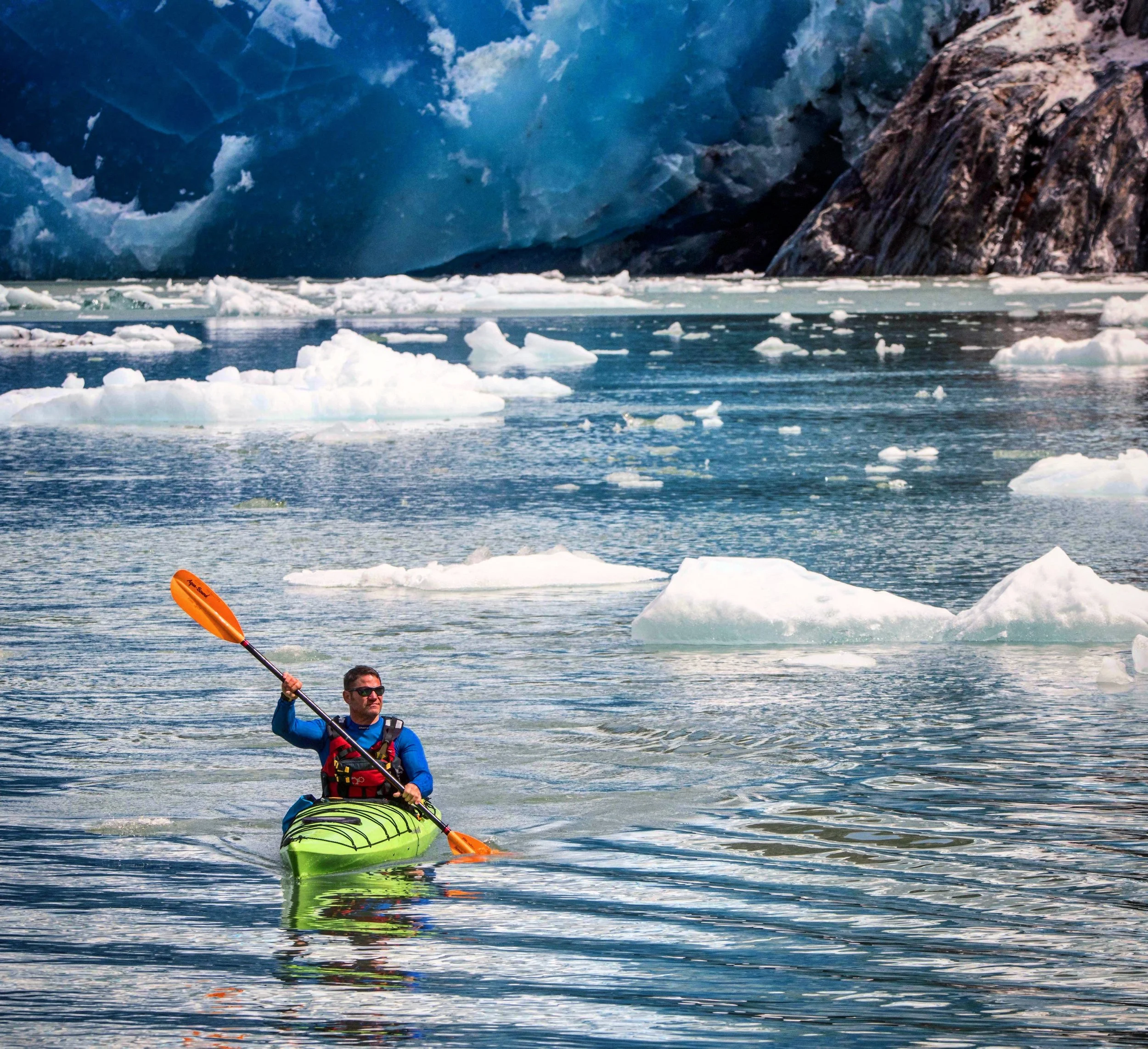
This brave person was kayaking near the glaciers (I was standing on a nearby boat!)
If your journey takes you farther north
Southeast Alaska is only one part of the state’s glacial story. Continue north along the Gulf of Alaska or into Prince William Sound and the scale shifts again.
Hubbard Glacier
Near Yakutat, Hubbard Glacier offers one of Alaska’s most dramatic contrasts. While most glaciers in the state have been retreating over the long term, Hubbard has advanced, and its movement has periodically altered the geography around Russell Fiord.
At Hubbard, the glacier itself becomes the event. The experience is less about a long ecological story or an intimate relationship with newly exposed land and more about the presence of an enormous moving body of ice meeting the sea.
I would come to Hubbard for scale. It does not need the intimacy of Reid or the gradual approach of Tracy Arm to justify itself.
Its presence is enough.
College Fjord
College Fjord in Prince William Sound creates a completely different feeling because no single glacier dominates the experience. Numerous glaciers descend from the surrounding Chugach Mountains, including Harvard and Yale at the head of the fjord, while other ice fills valleys in several directions at once.
The effect is cumulative. You move through the fjord and glaciers continue to appear, some reaching toward the water and others hanging high above it.
College Fjord is less about seeing one famous glacier than about seeing glaciation become the landscape itself.
Columbia Glacier
Columbia Glacier adds another useful perspective for travelers spending more time in Prince William Sound. Its enormous tidewater system and the iceberg filled water around it show another stage of an actively changing marine glacier landscape.
I would not make Columbia essential to understanding this article, but it belongs in the broader story for anyone continuing deeper into Prince William Sound. By this point in the journey, the goal is no longer to collect glacier names. It is to recognize how differently ice can inhabit Alaska.
How I would experience Alaska’s glaciers
For a first visit to Juneau, I would begin with Mendenhall. It offers the clearest introduction to the relationship among glacier, lake, forest and newly exposed land, while still leaving room in the day for another experience.
If I wanted to change the perspective completely, I would choose either a flight over the Juneau Icefield or a full day traveling into Tracy Arm or Endicott Arm. One takes you above the system and shows how the glaciers connect. The other takes you through the landscape the ice created.
For a deeper Southeast Alaska journey, I would begin allowing the glaciers to shape the itinerary rather than simply adding them to it. I would give Glacier Bay enough time for Margerie, Reid, Lamplugh, Johns Hopkins and the landscape between them to become part of the story. I would spend time in Petersburg and travel toward LeConte. While moving through the region, I would keep watching for Herbert, Eagle, Sumdum and Davidson rather than assuming the meaningful glacier experiences are only the ones I planned in advance.
If the journey continued farther north, I would allow the scale to change again. Hubbard would show me the extraordinary presence of a single glacier, while College Fjord would show what happens when ice begins filling the horizon.
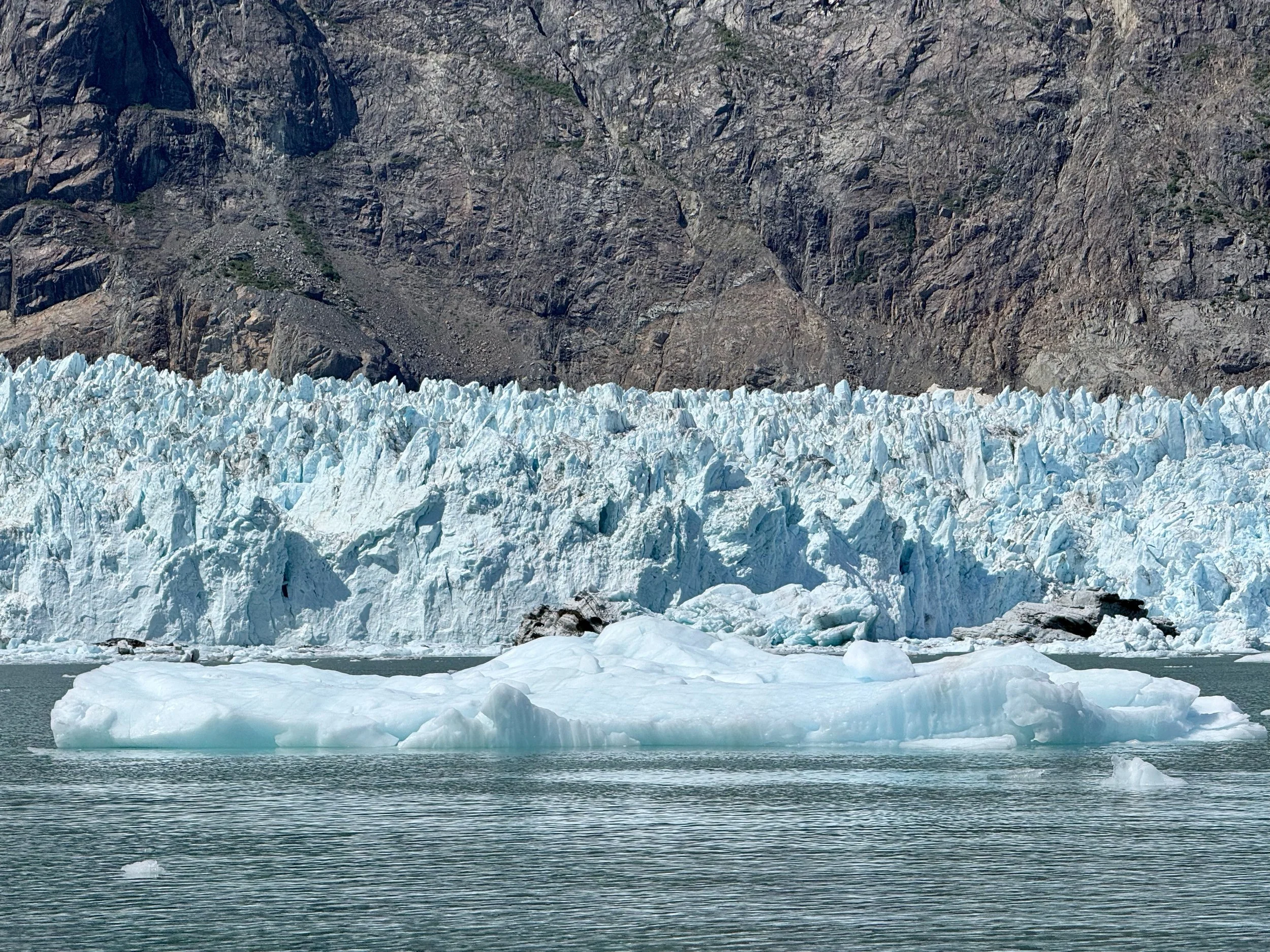
The face of Margerie Glacier in Glacier Bay, a beautiful and magnificent sight
The Alaska Edit
The most expensive glacier experience is not automatically the most meaningful, and the easiest glacier to reach is not a lesser version of the harder one. Mendenhall shows change across time. Tracy Arm and Endicott Arm show the long approach. Glacier Bay shows an entire landscape responding as ice retreats, advances and reshapes the country around it. Reid reveals what a glacier leaves behind, while Johns Hopkins reminds us that glaciers do not all behave in the same way.
LeConte gives you a reason to travel deeper into Southeast Alaska. Herbert, Eagle, Sumdum and Davidson remind you to keep looking while you move through it. The flight over the Juneau Icefield reveals how individual glaciers connect to something much larger, while a landing makes the ice physical and kayaking brings the experience back to human scale. Farther north, Hubbard shows sheer presence and College Fjord turns glaciers into an entire horizon.
Alaska’s glaciers are rivers of ice moving through mountains, sources of rivers, makers of fjords and evidence of a landscape that is still changing around us. Some deserve an entire journey. Others may appear unexpectedly through the window of a floatplane or above the bow of a boat.
What an experience to simply witness and understand the glacier system that continues to shape Alaska today.