The City With No Road Out
In Alaska’s capital, every road eventually meets water, mountain or ice. What appears to be isolation from the outside becomes a different way of understanding distance, freedom and home.
At the edge of Juneau, the road does not become another road.
There is no highway sign pointing toward the next town. No gas station marking the distance to a neighboring community. The pavement simply reaches the limit of where it can go, and the landscape continues without it.
The houses have already begun to thin. The forest has moved closer to the shoulder. Water appears through the trees, and the mountains rise beyond it with the kind of scale that makes the built world feel temporary. Somewhere behind you are neighborhoods, grocery stores, schools, government offices and the center of Alaska’s capital city. Ahead, there is no connecting route to Haines, Skagway, Anchorage or Canada.
There is only the end of the road.
For people accustomed to traveling across a connected continent, this can be difficult to imagine. Roads are so often understood as promises: keep following one and eventually another place will appear. A town becomes a suburb, a suburb becomes open country, and the highway continues toward somewhere else.
Juneau operates on different terms.
Every road here eventually stops. The city occupies a narrow space between the mountains and the sea, with an icefield rising behind it and water defining much of its edge. To arrive or leave, people generally take to the air or the water. Cars travel within the city, but they cannot carry you beyond it.
This is often presented as one of Juneau’s most interesting facts.
But living in a city with no road out is more than an interesting fact. Geography enters daily life here. It influences how people travel, how goods arrive, how plans are made and how residents understand the distance between themselves and the rest of the world.
It also complicates the meaning of freedom.
Why Is There No Road to Juneau?
You cannot drive to Juneau from another part of Alaska, Canada or the Lower 48 because the city’s local road system is not connected to the continental highway network.
Juneau is a capital city with many of the recognizable pieces of urban life: office buildings, apartment complexes, schools, restaurants, traffic, construction and the administrative machinery of state government.
It is also a place where the physical boundaries of the city remain plainly visible.
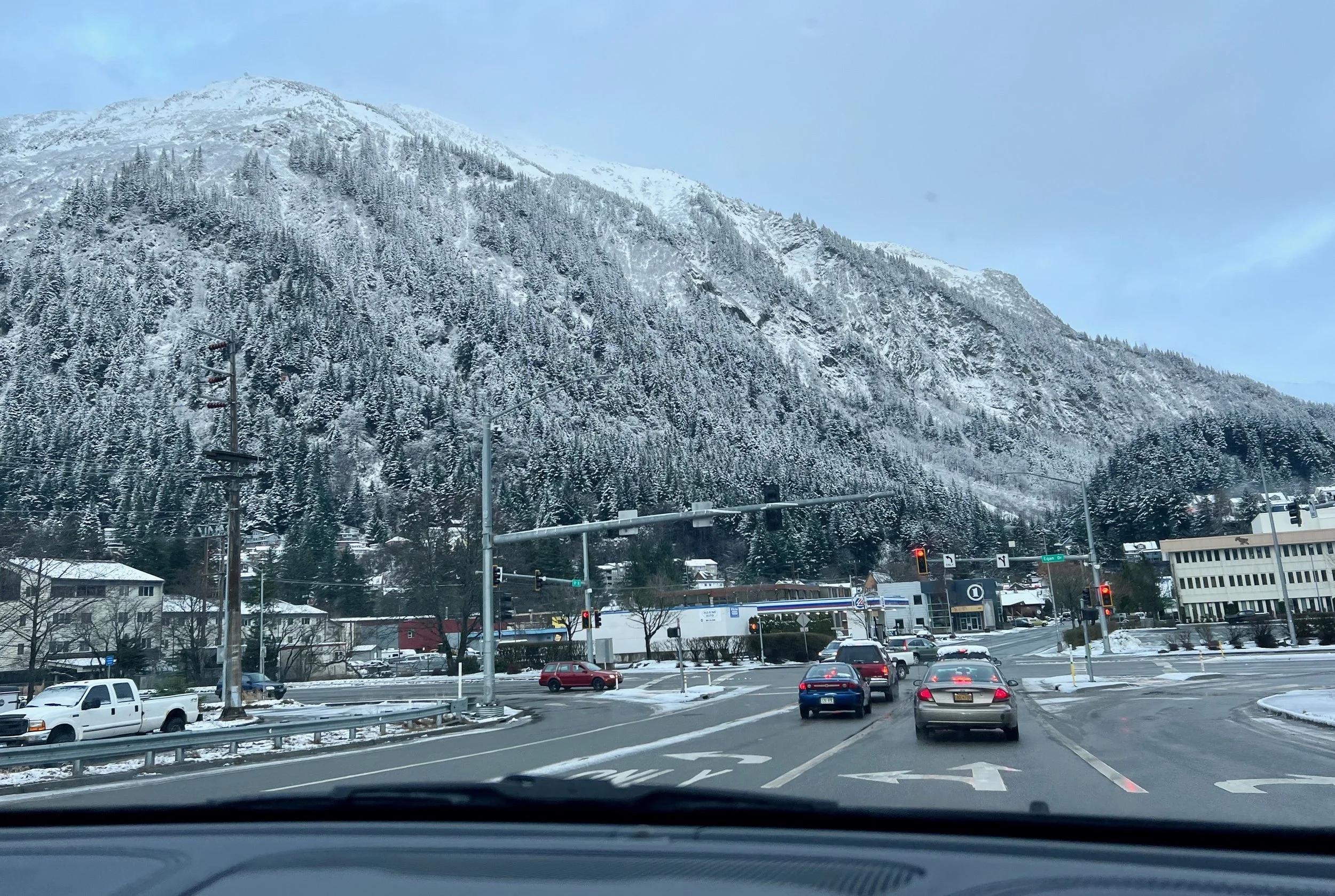
Mountains rise immediately behind downtown. Neighborhoods follow the limited stretches of land available between steep slopes and the channel. Roads trace the coastline because there are few other directions in which they can go. Even from the center of the city, the surrounding geography never fully disappears.
The landscape is not scenery placed around Juneau. It is the reason Juneau has its particular shape.
There have long been ideas about extending or connecting the road system. The possibility appears, recedes and returns in public conversation. But the practical reality remains: Juneau is not connected by highway to the rest of Alaska or the continent.
This changes the way distance works.
A community may be geographically close across the water and still require a flight, a ferry ride or a carefully coordinated journey to reach. Seattle can sometimes feel more accessible than another part of Southeast Alaska. A destination that looks nearby on a map may not be casually reachable at all.
The map shows distance in miles.
Life in Juneau measures it in weather, schedules, available seats and stretches of open water.
When Every Road Eventually Ends
Within Juneau, driving can feel perfectly ordinary.
There are morning commutes and school drop-offs. People stop for groceries, wait at traffic lights and complain about construction. A road carries you from downtown toward the valley, out toward the ferry terminal, past homes, harbors and trailheads.
But there is always a point at which the ordinary road begins to feel different.
Development becomes less dense. The spaces between homes widen. The forest presses closer. The road may narrow, follow the shoreline or pass places where the presence of the city feels increasingly faint.
Then it ends.
The existence of a visible edge changes the character of a place. In many American cities, the built environment seems capable of continuing indefinitely. One town blends into another. Roads multiply, development spreads and the boundary between city and region becomes difficult to locate.
Juneau cannot expand with the same apparent limitlessness.
Water, mountain and ice establish the terms. The natural world is not waiting beyond a distant suburban fringe. It is already here, shaping where homes can be built and where roads can run.
This containment can feel startling at first.
There is a psychological difference between choosing not to drive somewhere and knowing that you cannot. On the mainland, a car represents possibility even when it remains parked. You could leave after dinner. You could follow the highway for hours. You could cross a state line without making a reservation or checking whether the weather will cooperate.
In Juneau, leaving requires an additional decision.
You must choose a flight, a ferry or another route over the water. Departure is rarely accidental. It becomes an event with a time attached to it.
Four Ways the Road Ends
Juneau does not have a single symbolic end of the road. It has four physical ones, divided between the mainland and Douglas Island.
Each ends differently.
On the mainland, the road stretches north from downtown, through the Mendenhall Valley and along the coastline toward Berners Bay. We call it going ‘out the road’. The city gradually loosens along the way. Commercial buildings give way to homes, harbors, forest and long views across the water. By the time the road reaches its northern limit, Juneau feels less like a capital city than a narrow human settlement pressed against a much larger landscape.

The northern end of Juneau’s mainland road system near Berners Bay
The mainland road also extends south through Thane. Here, the route follows the water beneath steep mountain slopes, passing through a landscape marked by Juneau’s industrial history before reaching another stopping point. There is no next town beyond it. The road has followed the available strip of land as far as it can.

Juneau’s mainland road reaches its southern limit in the direction of Thane
Across the channel, Douglas Island contains two more endings.
At the north end of Douglas, the road dead-ends near the power plant. From there, a short trail continues where vehicles cannot, leading through the trees toward the ocean. The transition is almost immediate: pavement gives way to footpath, and the road’s ending becomes an entrance into another kind of access.

Douglas' main road reaches its northern limit with a walking trail that leads to the ocean
At the southern end of Douglas, the road stops more quietly, within a neighborhood near the Treadwell Ditch area. There is no dramatic overlook or official marker announcing that the route has run out. Homes occupy the final stretch, and beyond them the island continues without a public road carrying you farther.

Douglas' main road reaches its southern limit that leads to the ocean and forest
Together, the four endings form an unusual outline of the city.
One meets the forest and open water toward Berners Bay. One follows the mainland south through Thane. One becomes a trail leading toward the ocean. One disappears into a residential neighborhood on Douglas.
None leads to another community.
To travel between the ends, you must turn around and retrace the road through Juneau. The city’s road system does not pass through the landscape on its way somewhere else. It begins here, serves the people who live here and stops when the geography no longer allows it to continue.
That changes the meaning of an endpoint.
In most places, a dead end is a minor interruption; a street that failed to connect with another. In Juneau, the road endings reveal the underlying shape of the city. They show where pavement has negotiated with mountain, forest and water, and where the landscape has ultimately set the boundary.
The Other Highway
At each of Juneau’s four road endings, the pavement stops near a landscape that continues far beyond it.
Much of that landscape is water.
From a road map, Juneau can appear enclosed: a small network of streets ending against mountain, forest and shoreline. From the water, the geography looks entirely different. Channels open into bays. Passages continue between islands. Coastlines lead north and south through a region that is far larger than the road system suggests.
The road may be limited.
The marine highway is expansive.
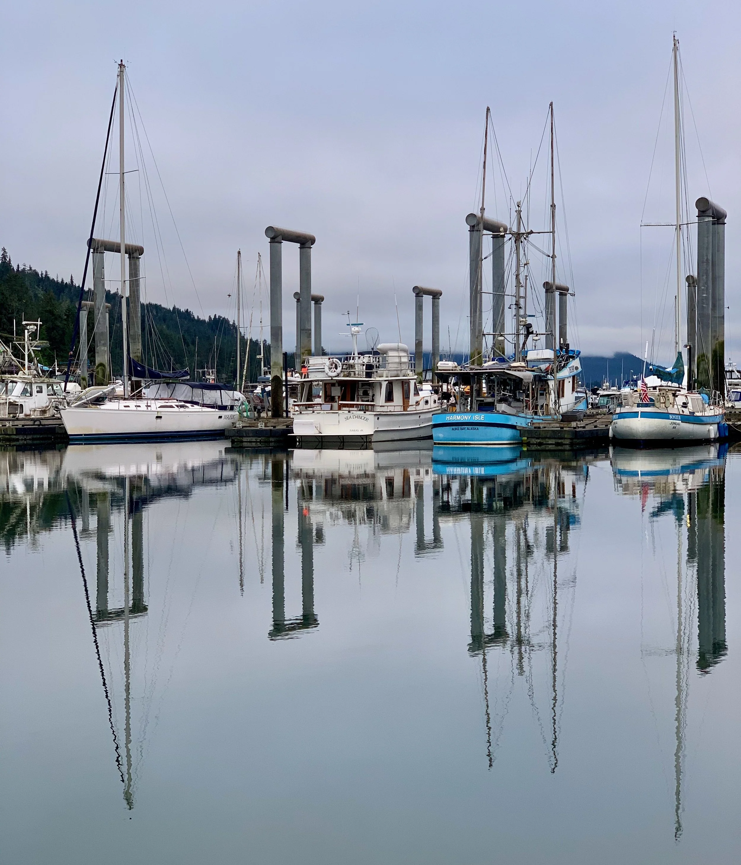
For some residents, that means traveling aboard the ferries that connect Southeast Alaska’s communities. For others, it means owning a skiff, fishing boat, sailboat or larger vessel of their own. Juneau’s harbors are filled not only with transportation, but with another way of living. Some people keep boats for weekend trips. Some use them to fish, hunt or reach cabins and remote shorelines. Others live aboard them, making the harbor itself a neighborhood.
A boat changes the map.
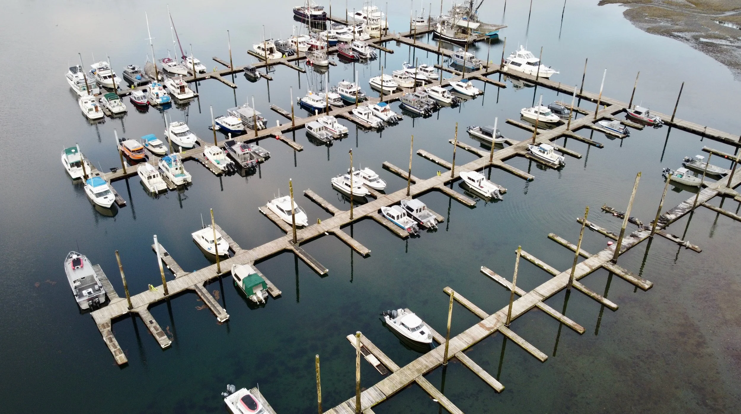
Starter Harbor from above
Places that cannot be reached by car become part of the surrounding world: coves, islands, beaches, cabins and stretches of coastline with no road leading to them. A person can leave the harbor and follow the water into a geography that feels almost endless.
This helps explain why Juneau’s limited road system does not always create a limited sense of movement.
In many places, freedom is associated with a full tank of gas and an open highway. In Juneau, it may begin at a boat launch. The routes are shaped by tides, weather, fuel, skill and the condition of the water rather than painted lanes and road signs. Travel requires a different kind of knowledge, but the possibilities widen almost immediately after leaving shore.
The waterways are not empty spaces between communities.
They are the routes connecting them.
This is especially visible in Southeast Alaska, where towns separated by mountains and forest often face one another across open water. Ferries, fishing boats, private vessels and commercial traffic move through the same channels. The region’s geography makes water not merely part of the scenery, but part of the infrastructure.
Seen this way, Juneau is not a city whose roads have failed to continue.
It is a city built around a different understanding of how continuation works.
The pavement ends. The shoreline does not.
Everything Arrives Another Way
The lack of a highway is most visible when people travel, but its effects extend far beyond the airport and ferry terminal.
Much of what sustains daily life must arrive by air or water.
Groceries, building materials, household goods and vehicles cross distances that residents elsewhere rarely need to consider. A car on a Juneau road has already made a journey that did not happen on its own wheels. The lumber used to build a home, the produce arranged in a grocery store and the packages waiting on a doorstep have all entered through systems that remain mostly invisible once the items arrive.
Until something interrupts them.
Bad weather can delay flights. Marine schedules can shift. A missed connection can change an entire day. Travel plans sometimes begin with the understanding that the plan may not survive contact with Southeast Alaska weather.
Residents learn to leave room.
They learn which departures are dependable, how much time to allow and when a same-day connection is an unnecessary gamble. They understand that an important appointment elsewhere may require leaving earlier than seems reasonable. Some keep an eye on the forecast with the attention people in connected cities reserve for traffic.
This does not make daily life feel constantly precarious. Most days, the systems work. Planes arrive. Barges unload. Store shelves fill. People go to work and return home without thinking deeply about the geography that made the day possible.
But Juneau does not allow the illusion that movement is entirely under human control.
Weather remains part of the infrastructure.
So does water.
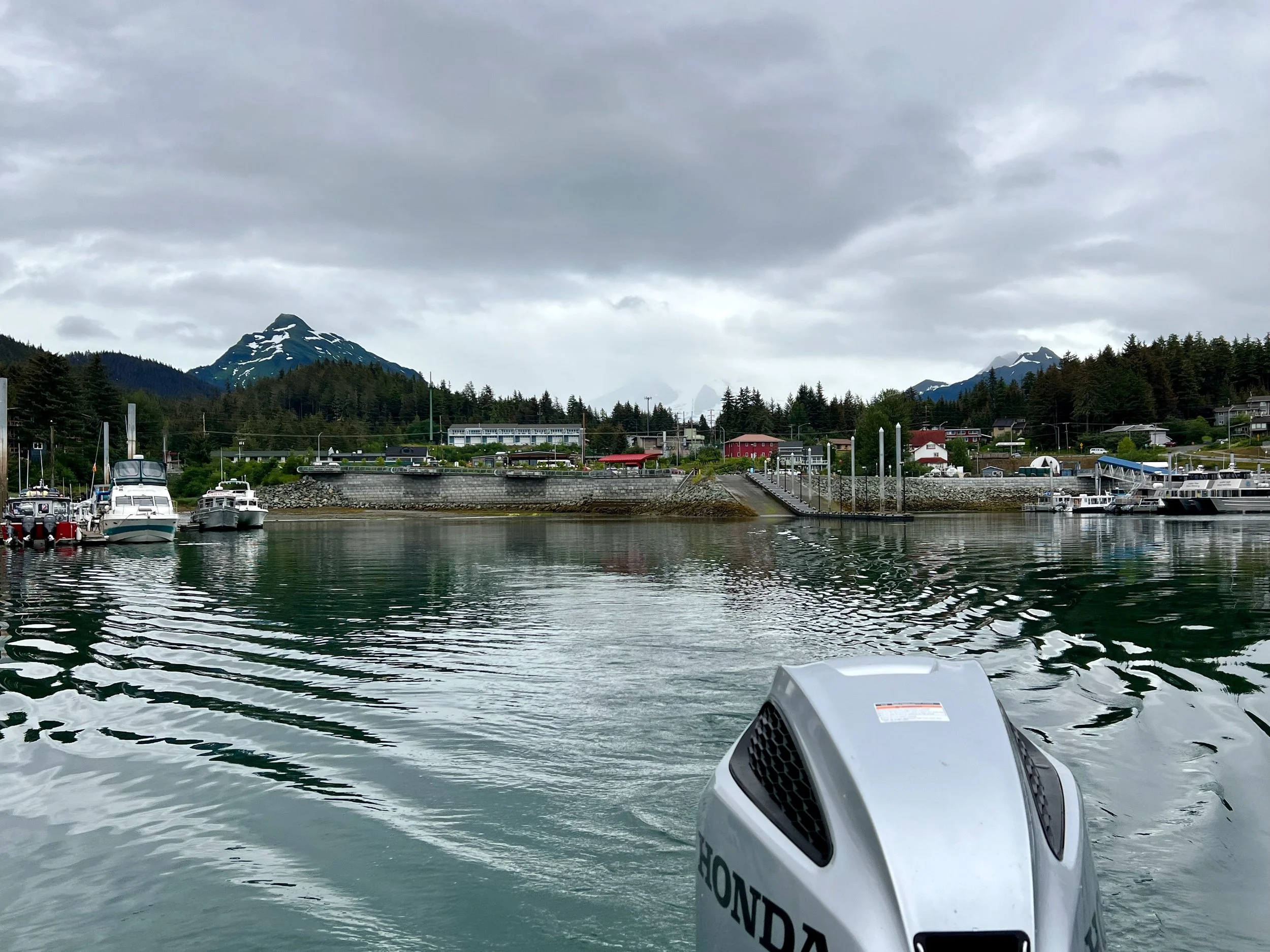
Leaving Statter Harbor, Auke Bay
The Freedom Inside the Boundary
From the outside, a city with no road out can sound confining.
The limits are easy to describe. You cannot get into a car and drive to another town. You cannot continue north toward the interior or south toward the Lower 48. Leaving requires a flight, a ferry or a boat and usually some degree of planning.
But Juneau complicates the idea that freedom is measured by how far a road can take you.
Within the city’s visible boundaries, the natural world is remarkably close. Trails begin near neighborhoods and rise quickly into forest and mountain country. Beaches, wetlands, waterfalls and glacier-fed landscapes sit within the rhythm of ordinary life. A person can leave work and, within a short time, be walking beneath old-growth trees or looking across water toward mountains with no road through them.
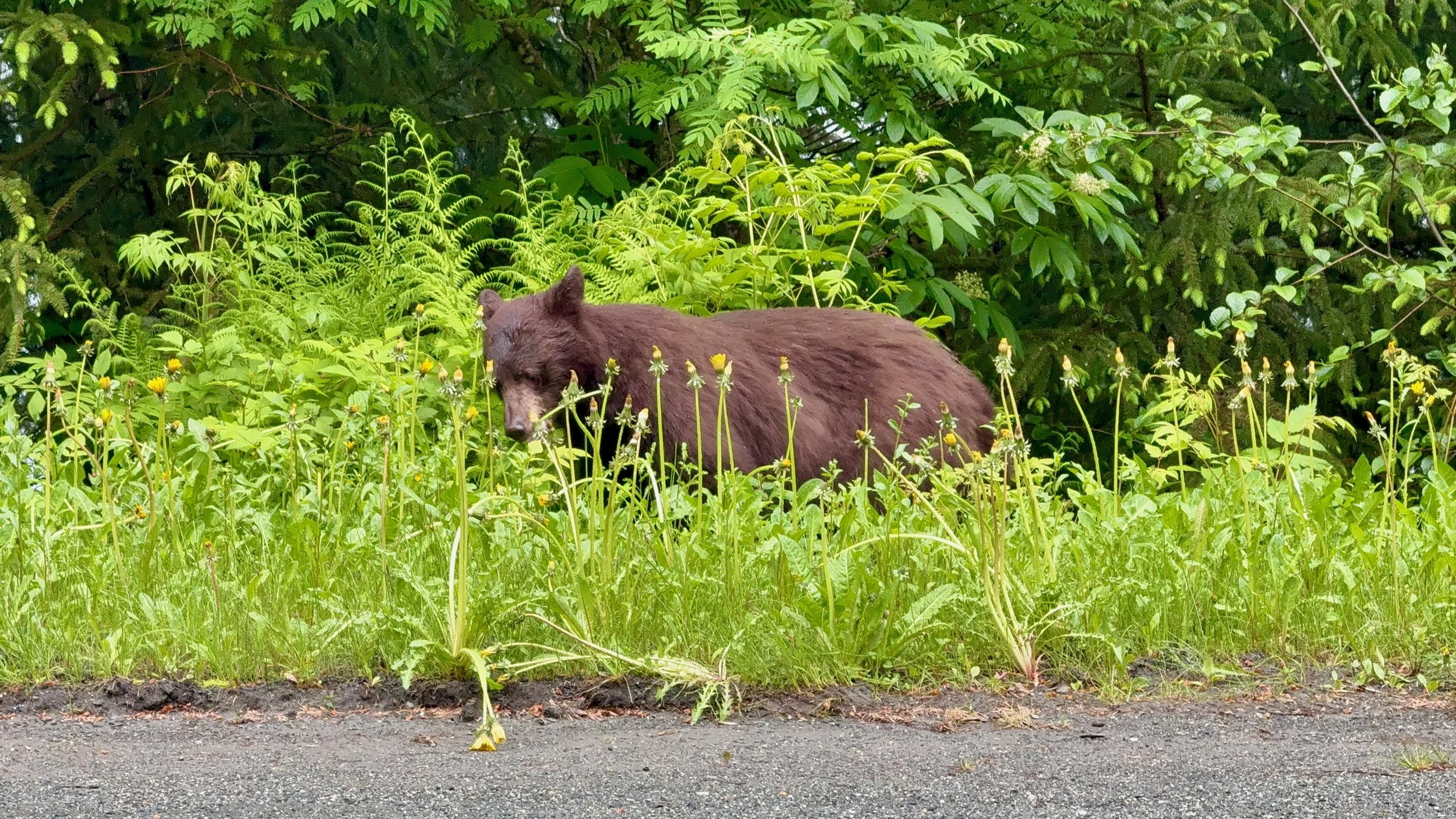
A bear munching dandelions alongside the road (as I was heading ‘out the road’)
The city may be geographically contained, but life within it does not always feel small.
Part of that comes from scale. Mountains rise directly behind homes and office buildings. Weather moves visibly across the channel. Wildlife passes through places that would feel firmly urban elsewhere. Eagles perch above parking lots. Bears cross roads and yards. Whales may surface within sight of where people live and work.
The wilderness is not positioned beyond the city as a separate destination.
It is threaded through it.
That proximity changes what access means. In many places, reaching a wild landscape requires driving for hours, passing through layers of development before the city finally loosens its grip. In Juneau, the transition can happen within minutes. Pavement becomes trail. Neighborhood becomes forest. The built environment gives way before it has had much room to spread.
There are restrictions here, but there is also depth.
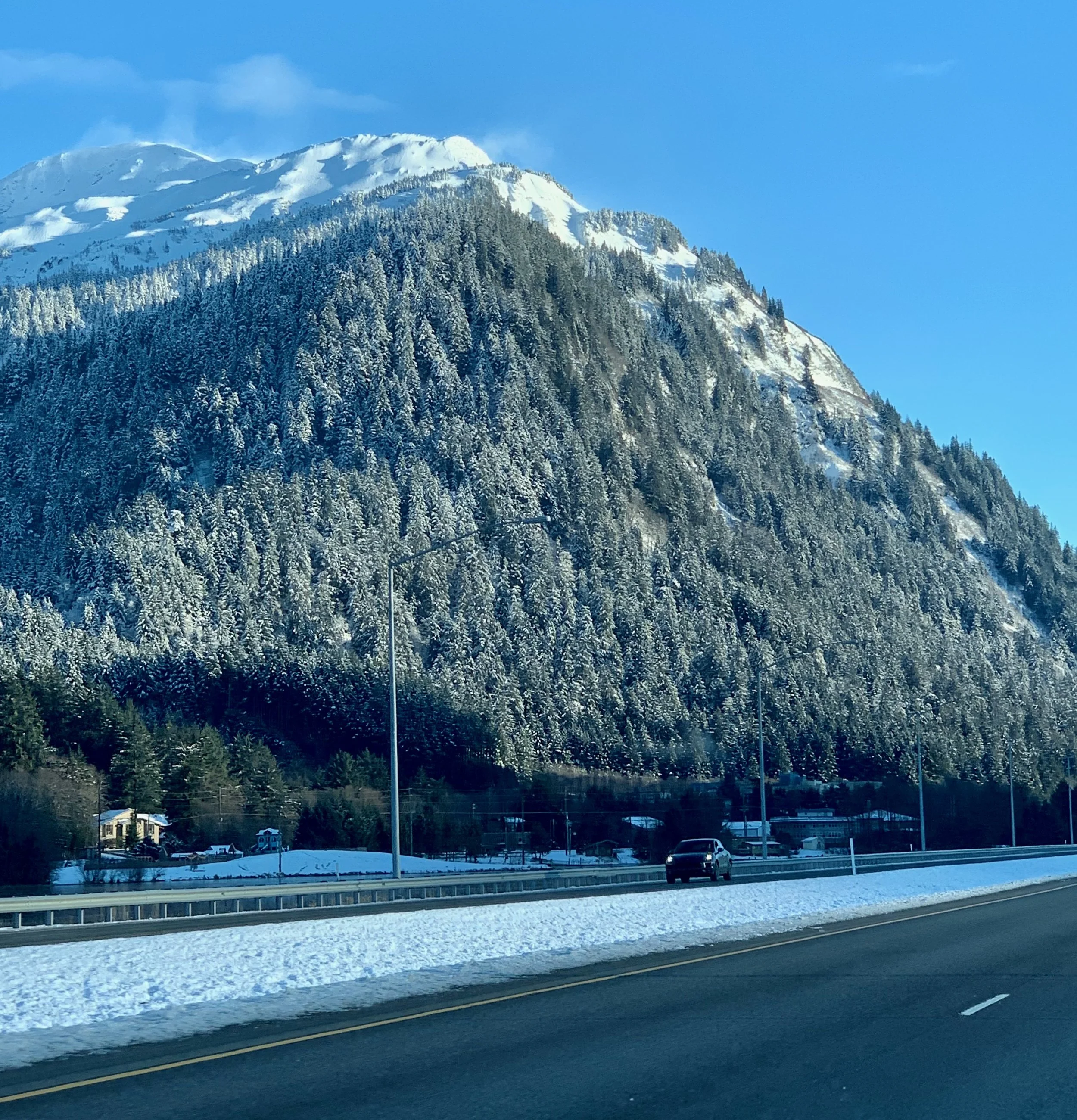
View of Glacier Highway during the winter months
You may drive the same roads repeatedly, yet encounter a place that looks different with the tide, the season, the weather or the light. A familiar trail can disappear into fog. A mountain hidden for days can suddenly reappear. The landscape does not need to extend endlessly in order to keep revealing something new.
Perhaps that is the freedom Juneau offers.
Not the freedom to keep going in every direction, but the freedom to go deeply into the place where you already are.
The city’s boundaries are real. So is the expansiveness contained within them.
What Isolation Actually Means
It is tempting to romanticize a place like Juneau.
Words such as remote, wild and isolated carry a certain beauty when viewed from a distance. They suggest independence, quiet and an escape from the friction of more connected places.
Living here makes those words less simple.
Isolation can mean expense. It can mean fewer choices, longer waits and travel that requires planning. It can mean watching a storm alter a trip that mattered. It can mean feeling the limits of the city more acutely during a long season, or realizing that the person, service or experience you need is not available without leaving.
Sometimes the road system feels sufficient and sometimes it feels very small.
The same boundary can provide peace one day and restlessness the next. That tension is not a failure to appreciate the place. It is part of understanding it honestly.
Juneau is also not disconnected in the way outsiders sometimes imagine. It is a state capital linked politically, economically and culturally to a much larger world. People come and go constantly. Flights connect the city south and north. Ferries move through the region. News, work and relationships cross the same distances they do anywhere else.
What differs is the physical experience of connection.
Here, connection must cross something.
It must cross water, weather, mountain or air. It arrives visibly, sometimes noisily and occasionally late. The systems that link Juneau to the rest of the world are not abstract. You can watch them land, dock and unload.
Perhaps that visibility creates a different relationship with place.
When leaving requires intention, staying becomes more noticeable too.
The Geography of Home
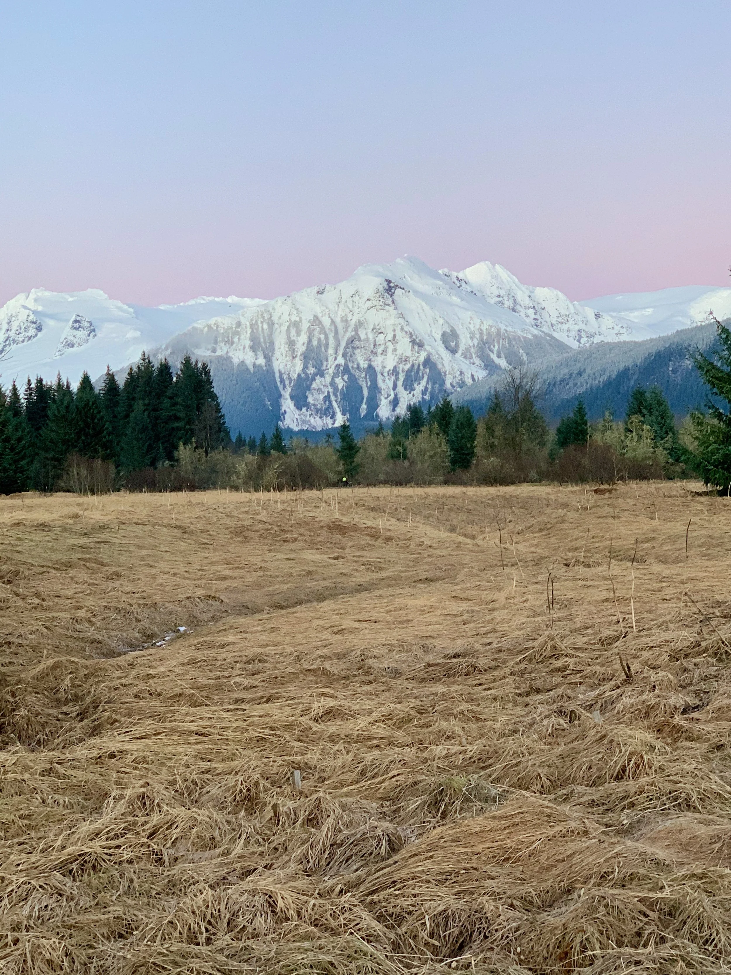
View of the mountains from Glacier Highway
Juneau becomes the point from which the rest of the world is measured. A flight is not a route back to civilization; it is simply how a person travels from home. The ferry is not evidence of remoteness but part of the transportation system. The surrounding mountains are not barriers encountered at the edge of ordinary life. They are part of the view from the grocery store, the office and the kitchen window.
At the end of the road, there is no sign explaining what the place means.
The pavement simply stops. A neighborhood, a power plant, a trail, a forest or a stretch of shoreline marks the point beyond which a car cannot continue. To reach another community, you must turn around or choose a different way forward.
That is the part a road map cannot fully show.
It can trace the limited miles of pavement across the mainland and Douglas Island. It can mark the places where those lines end. But it cannot capture the trails continuing into the forest, the boats leaving the harbor, or the waterways opening between islands and along hundreds of miles of coastline.
Juneau’s geography places real limits on daily life. Travel requires intention. Weather has a vote. Certain things cost more, take longer or remain out of reach. There are days when the boundaries of the city feel protective and others when they feel unmistakably small.
But living here also changes the way a boundary is understood.
An ending does not always mean there is nowhere else to go. Sometimes it means the mode of travel must change. The pavement becomes a trail. The shoreline becomes a launch point. A channel that appears to separate one place from another becomes the route between them.
Perhaps that is what the four ends of the road reveal most clearly.
Juneau is contained, but it is not closed. Its roads may be finite, but the landscape around them is not. Beyond the final stretches of pavement are forests, mountains and waterways that continue far past anything a highway could reach.
Even though the road ends here, the way forward does not.
See More of Juneau
The roads may end, but there is much more to explore. Continue to The Juneau Edit for the places, experiences and practical guidance worth making time for.